Benidorm then and now
From a fishing village on its headland to a city of skyscrapers – in historic photos from archives that make their collections freely available.
Then & now
Drag the slider to switch between then and now.
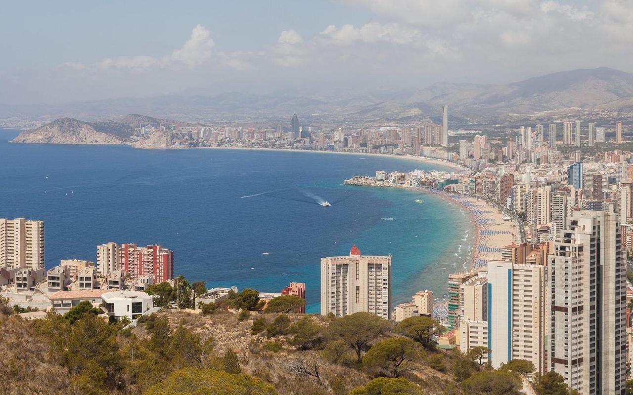
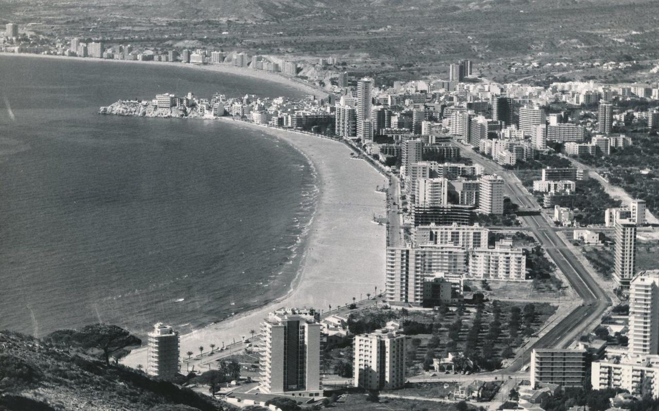 19702014
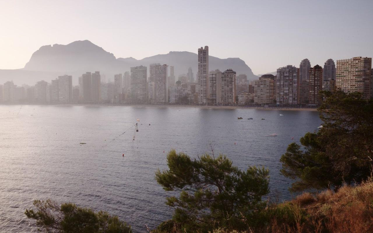
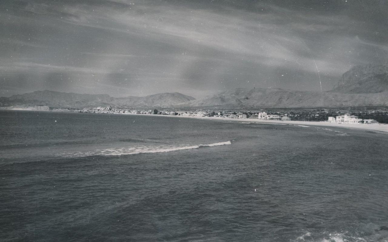 19542017
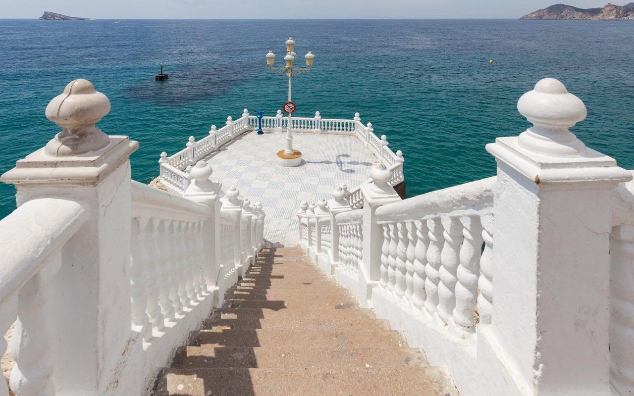
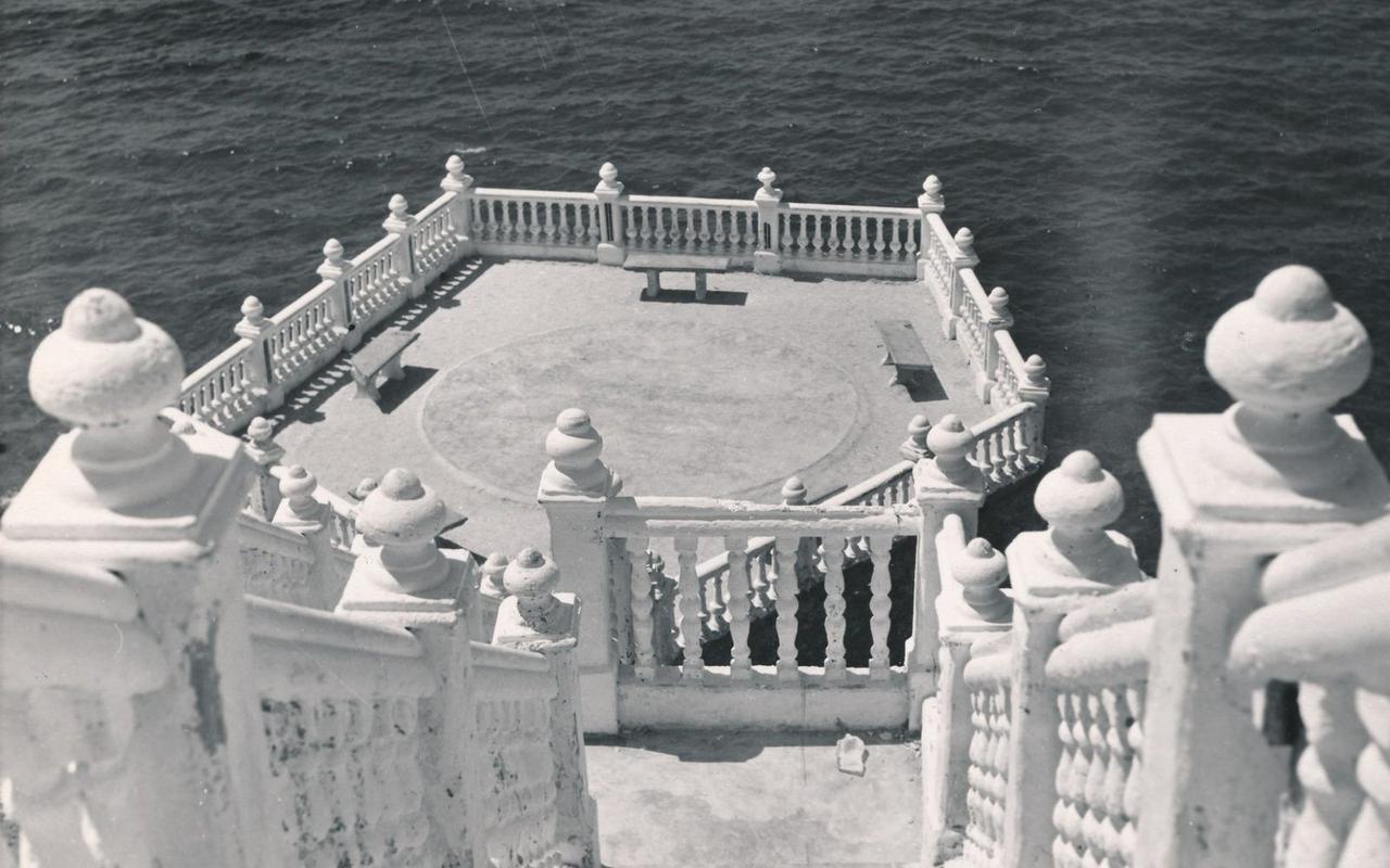 19572014
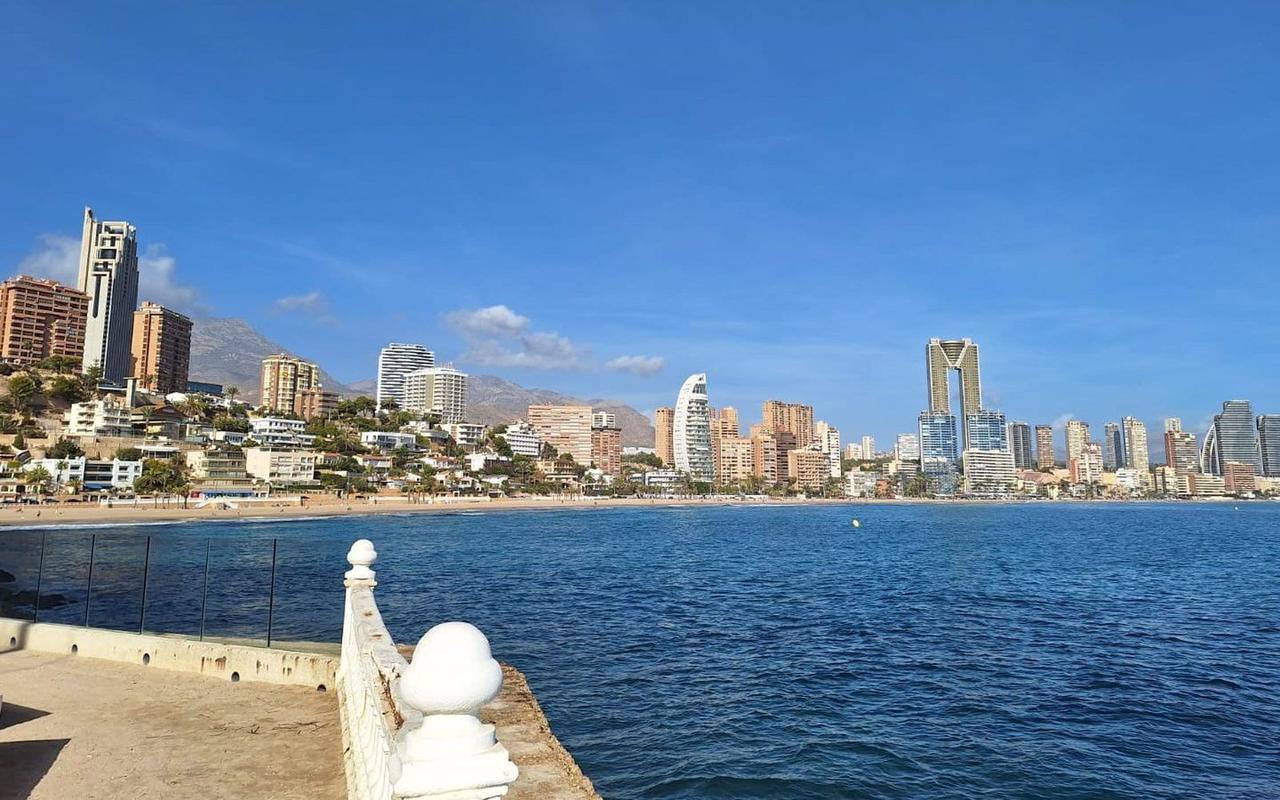
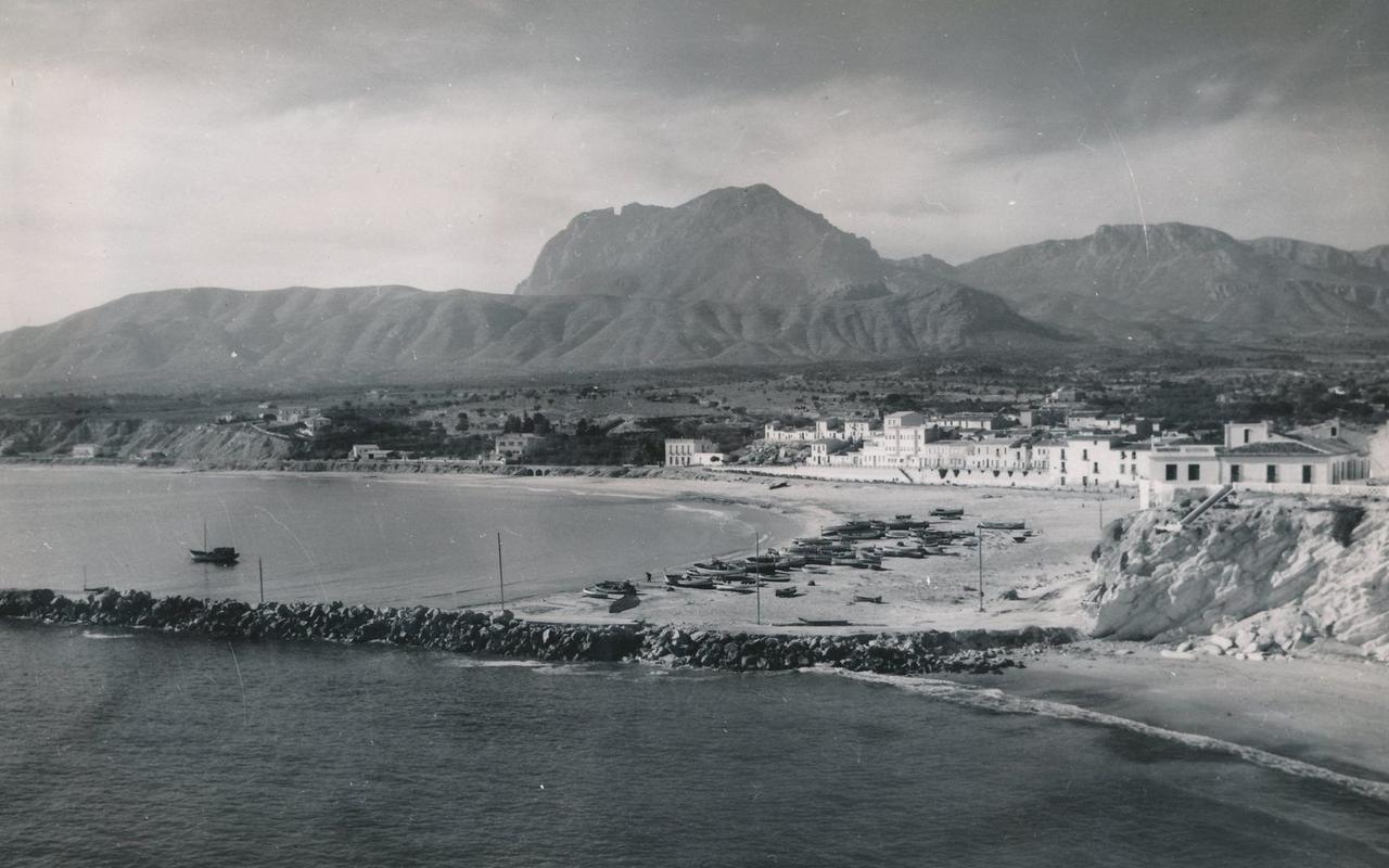 1954today
From fishing village to skyline
- 1859
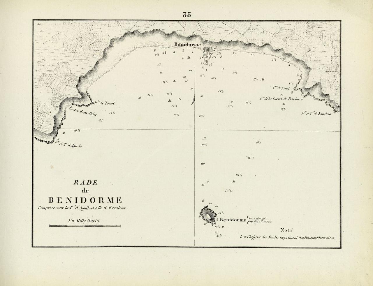
Chart of the roadstead, a French re-engraving of the Spanish survey of 1813: a village on the headland, the island offshore.Chart: Maistre, Marseille 1859 · Archivo General Militar de Madrid, Biblioteca Virtual del Patrimonio Bibliográfico, CC BY 4.0 - around 1930
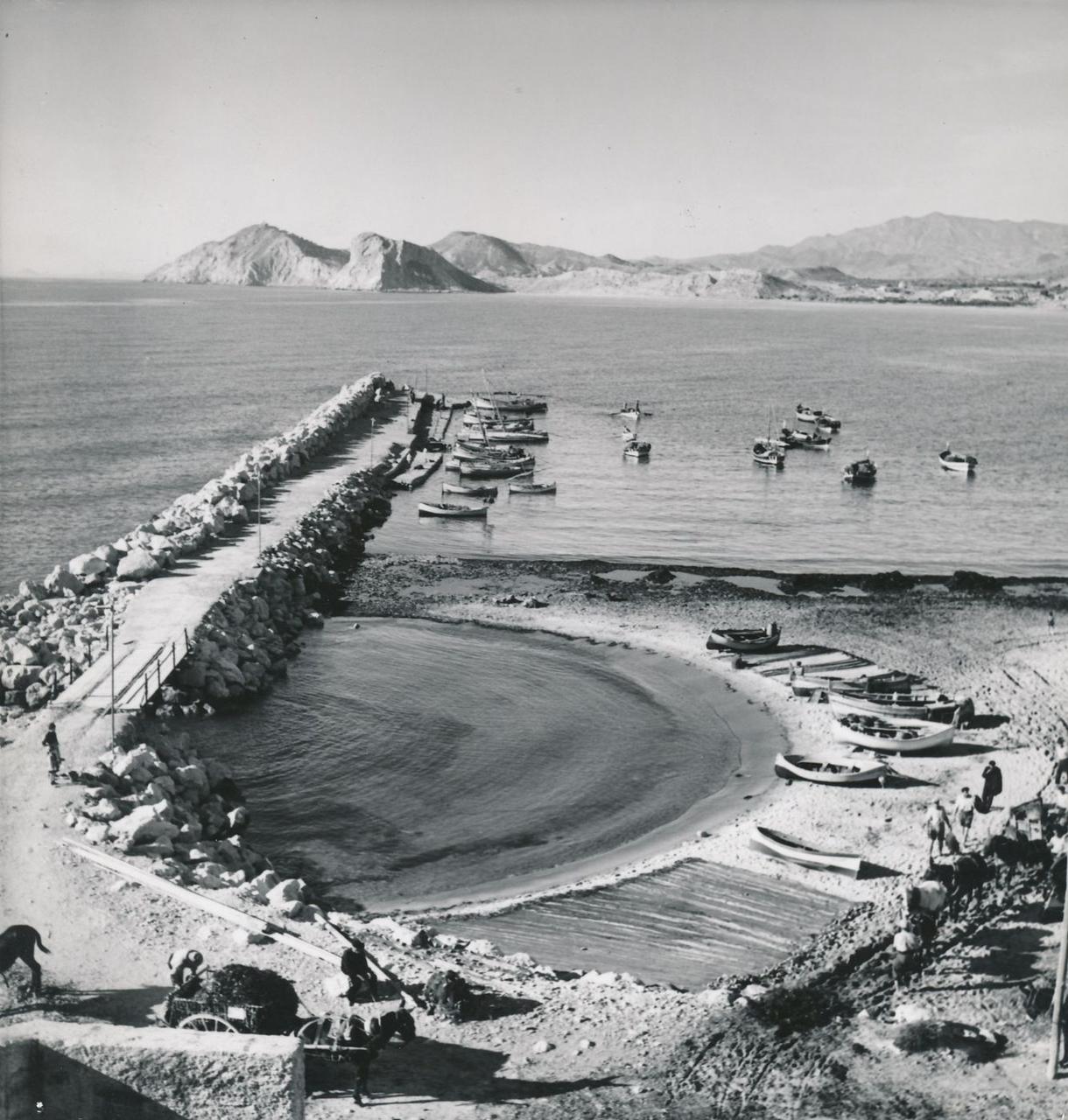
The harbour wall with fishing boats. Behind it, Poniente beach – empty.Photo: Ilse Steinhoff, Legado Fernández Fuster / Universidad de Zaragoza, CC BY-SA 2.0 - early 1930s
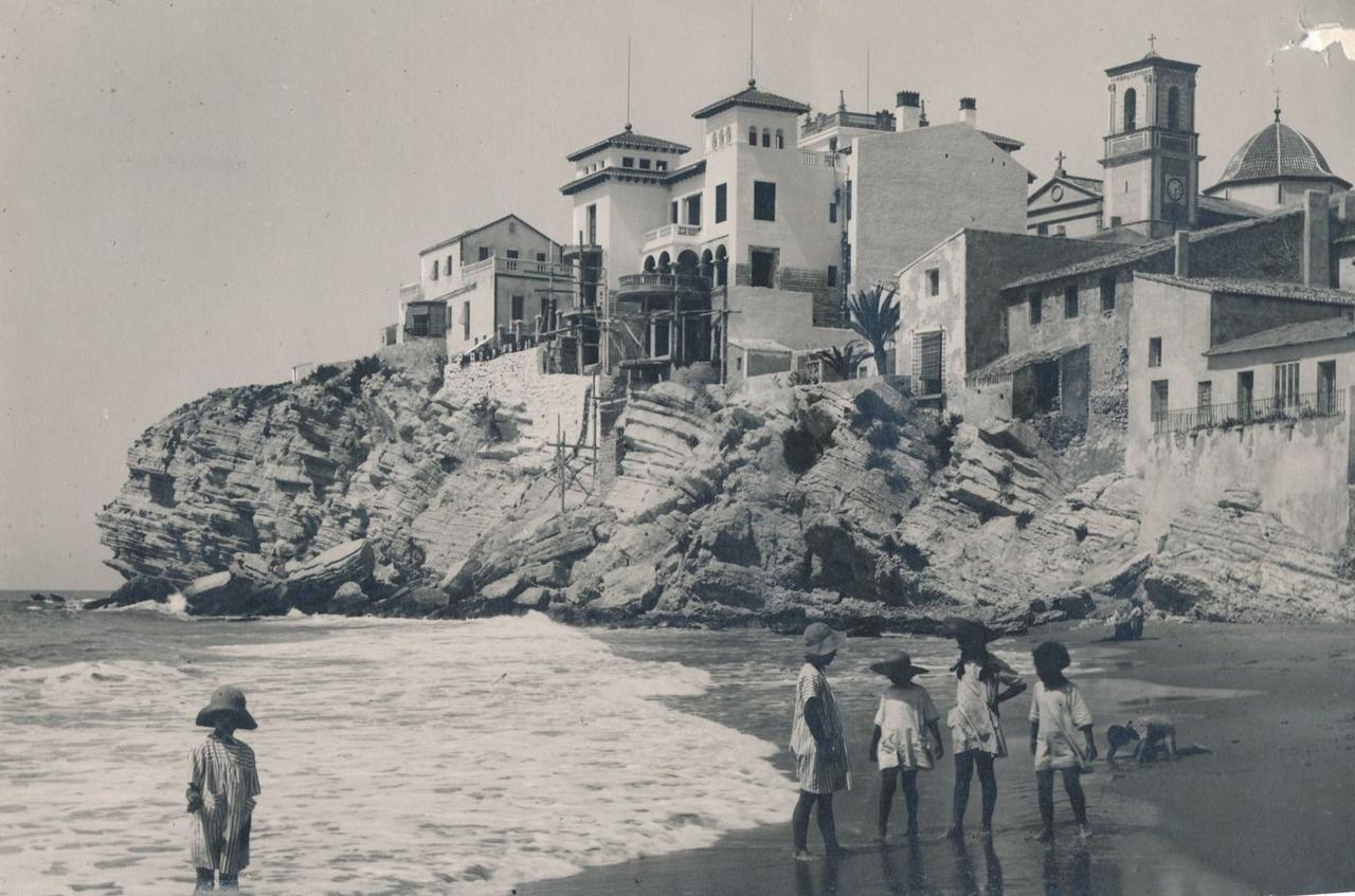
Children on the beach below the old-town rock. The new villas are still under scaffolding.Photo: Patronato Nacional de Turismo, Legado Fernández Fuster / Universidad de Zaragoza, CC BY-SA 2.0 - 1942
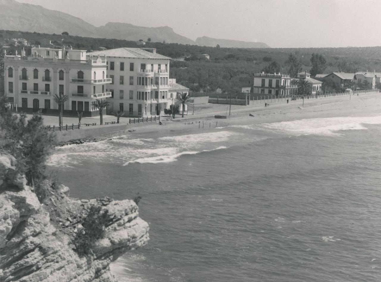
A handful of hotels and villas on Levante beach, nothing but fields behind.Photo: Sánchez, Legado Fernández Fuster / Universidad de Zaragoza, CC BY-SA 2.0 - before 1950
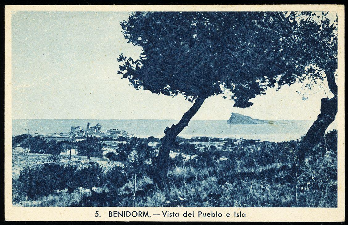
Postcard: the old town and the island seen from inland, with fields and pines in between.Photo: Biblioteca Valenciana, Public Domain Mark - 1959
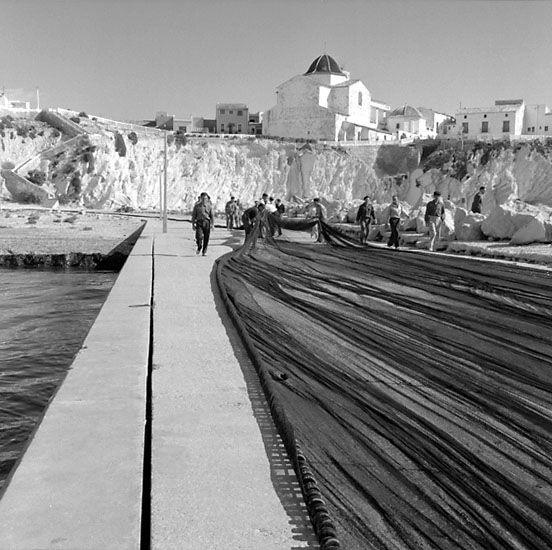
Fishermen haul their nets along the harbour wall. The same year the first package tourists arrive, flying in via Valencia.Photo: Olof Hasslöf, Bohusläns museum, Public Domain Mark - around 1960
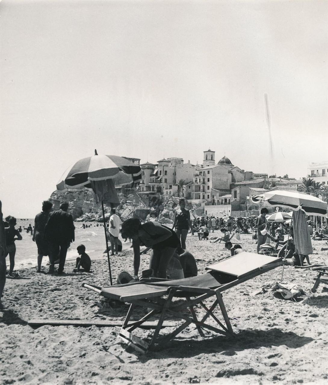
Deckchairs, parasols, packed beaches: the fishing village has become a resort.Photo: E. de la Vega, Archivo Fotográfico de la Dirección General de Turismo / Universidad de Zaragoza, CC BY-SA 2.0 - 1960
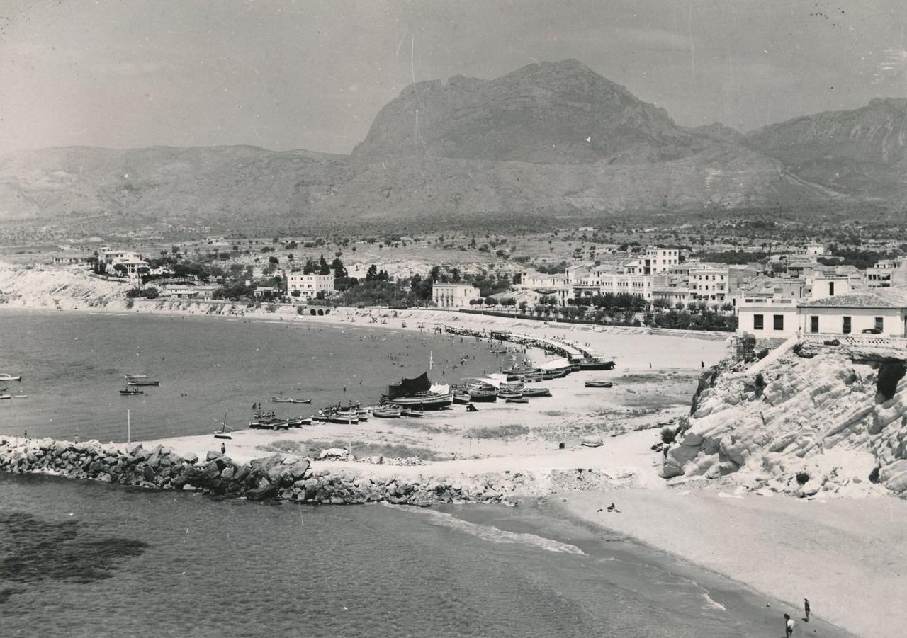
Poniente: sunshades on the beach, the first hotels on the seafront. The fields behind are still open.Photo: Archivo Fotográfico de la Dirección General de Turismo / Universidad de Zaragoza, CC BY-SA 2.0 - 1961
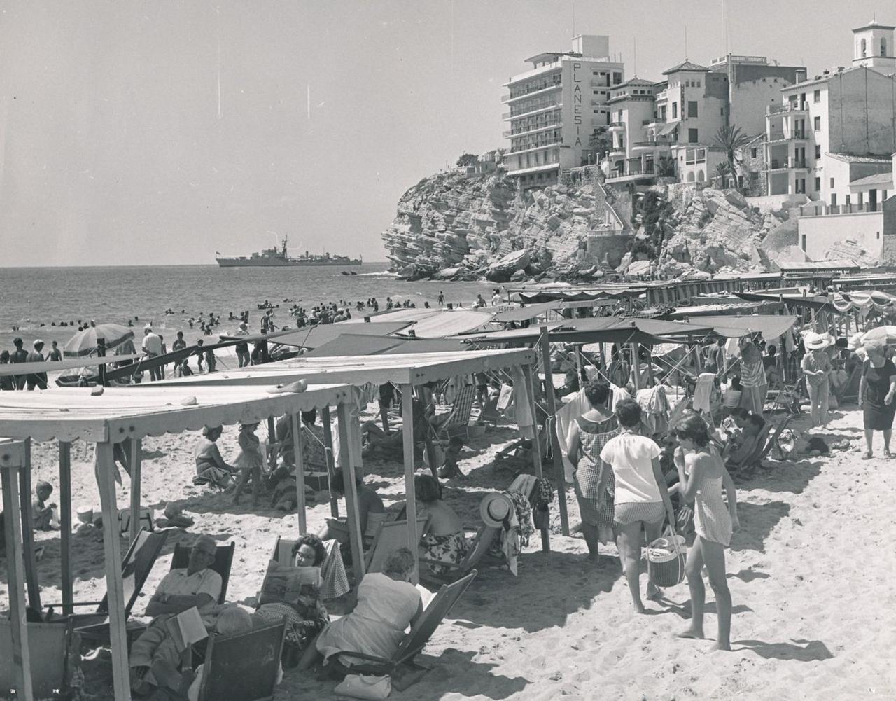
Hotel Planesia, opened around 1960, is one of the first new buildings to rise above the old town.Photo: Archivo Fotográfico de la Dirección General de Turismo / Universidad de Zaragoza, CC BY-SA 2.0 - before 1963
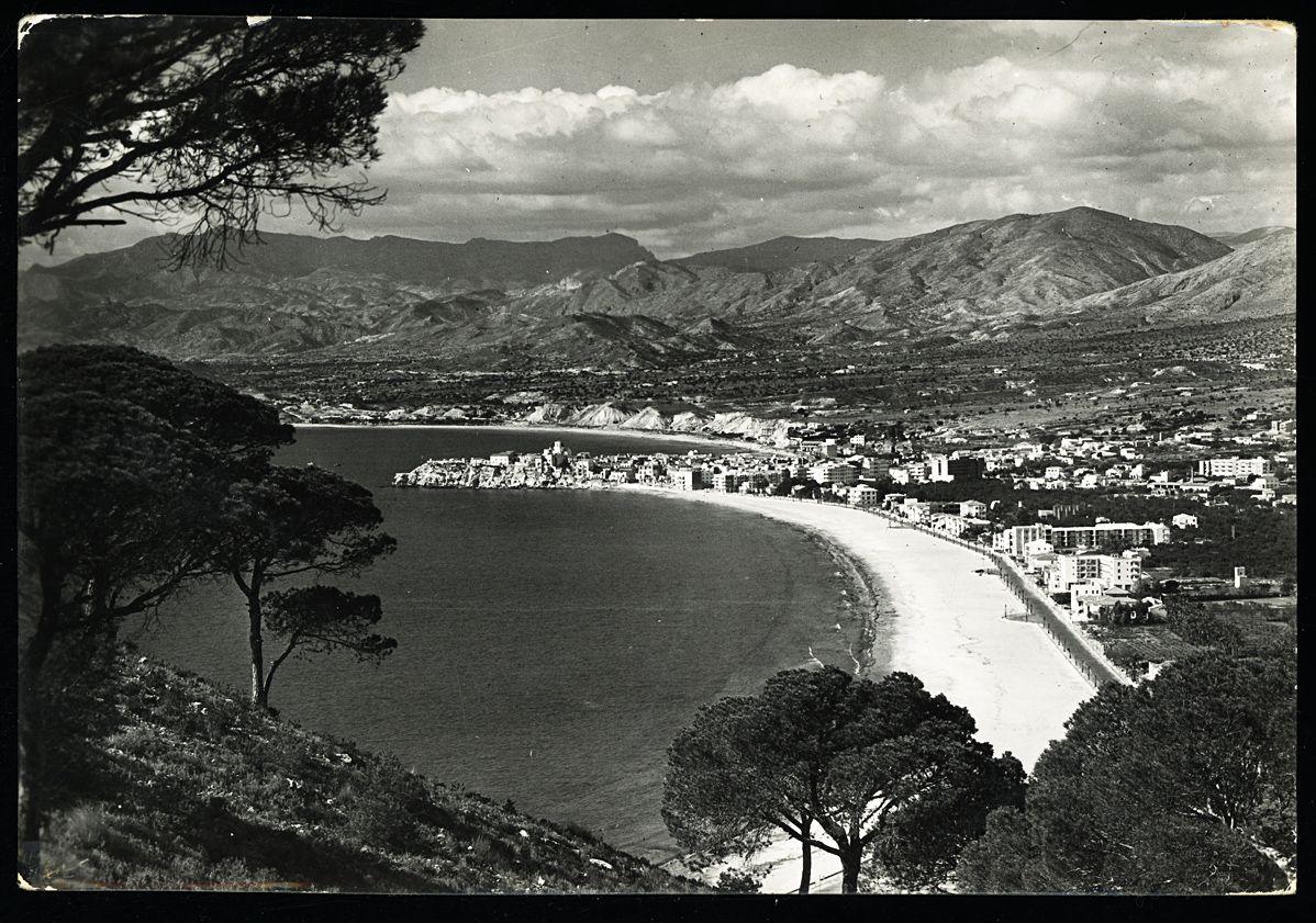
Postcard from the Serra Gelada: promenade and first apartment blocks, but no high-rise yet.Photo: Rueck (Marvellí), Biblioteca Valenciana, Public Domain Mark - 1963
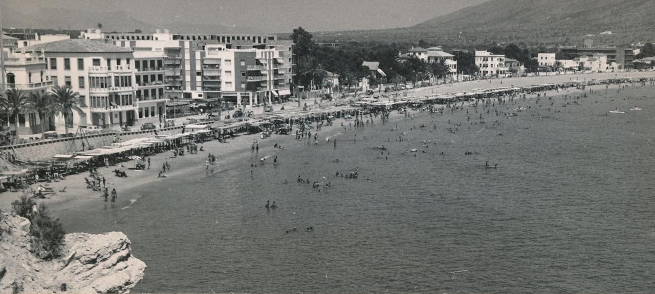
Start of Levante beach: the same row of houses as in 1942, larger blocks behind, rows of sunshades in front.Photo: Archivo Fotográfico de la Dirección General de Turismo / Universidad de Zaragoza, CC BY-SA 2.0 - late 1960s
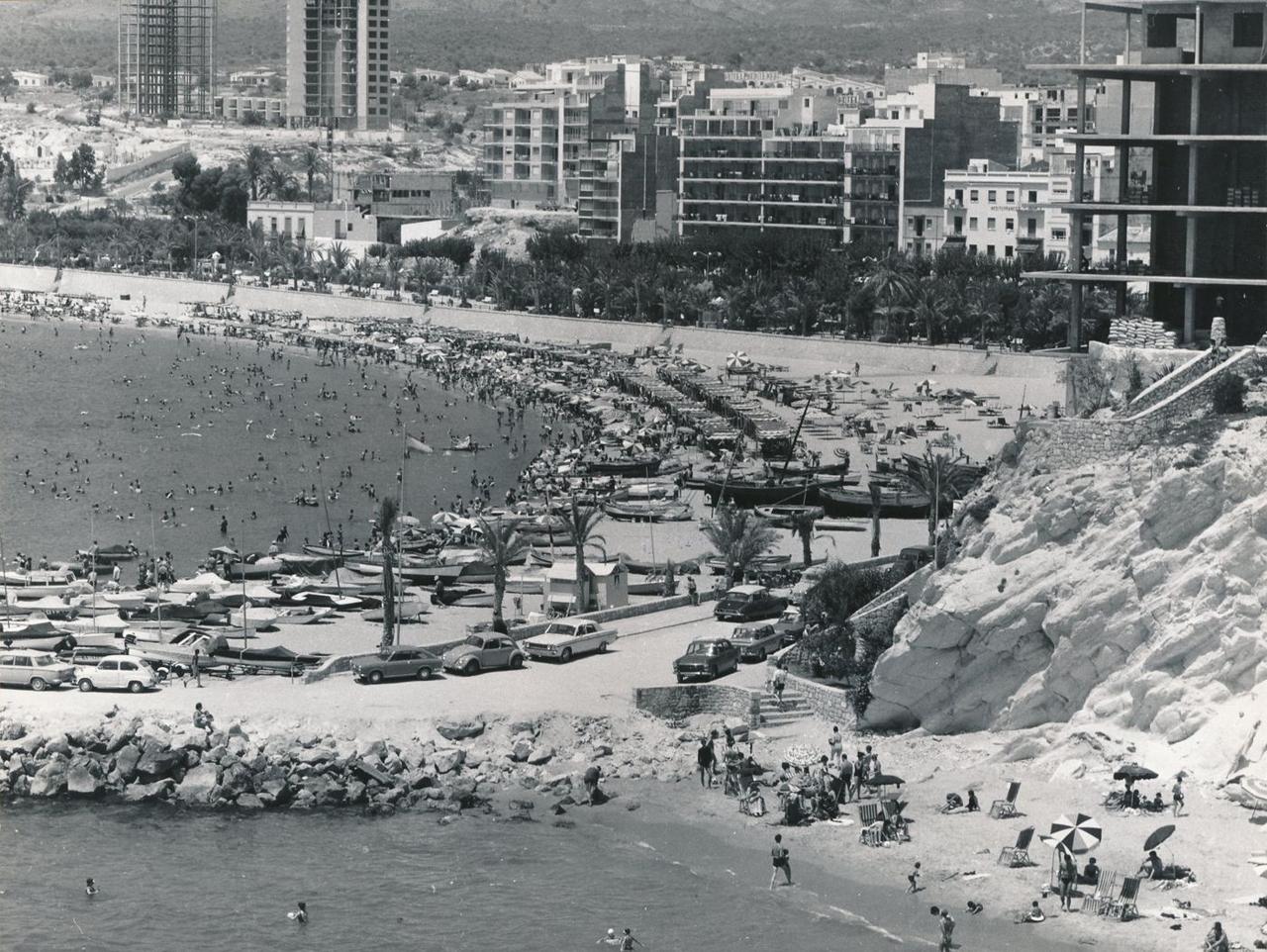
Two high-rises go up behind Poniente, one still a concrete frame.Photo: Sánchez, Archivo Fotográfico de la Dirección General de Turismo / Universidad de Zaragoza, CC BY-SA 2.0 - around 1967
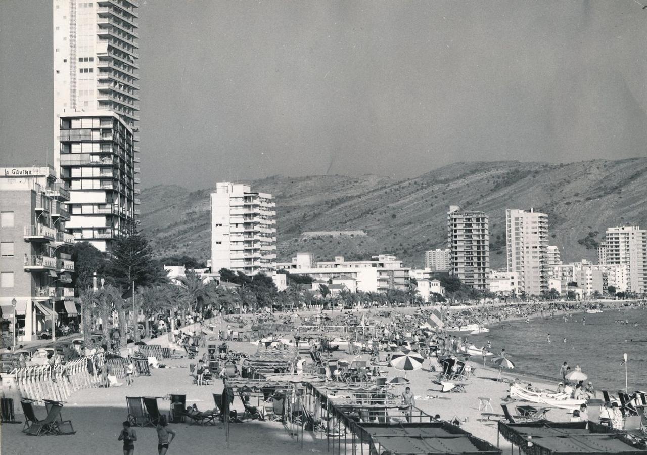
Looking east from Hotel Planesia: the first towers stand on Levante beach.Photo: Archivo Fotográfico de la Dirección General de Turismo / Universidad de Zaragoza, CC BY-SA 2.0 - 1970
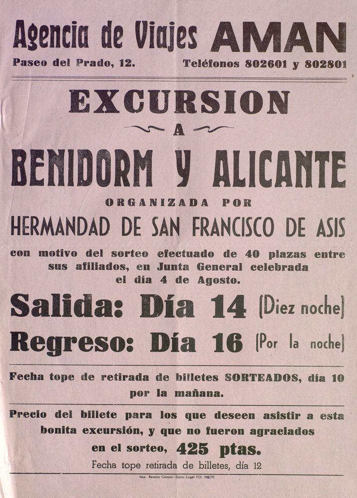
Poster from Talavera de la Reina: a brotherhood raffles 40 seats on a coach trip to Benidorm and Alicante, tickets 425 pesetas.Poster: Agencia de Viajes Aman, Talavera de la Reina · Biblioteca de Castilla-La Mancha, CC BY 4.0 - around 1970
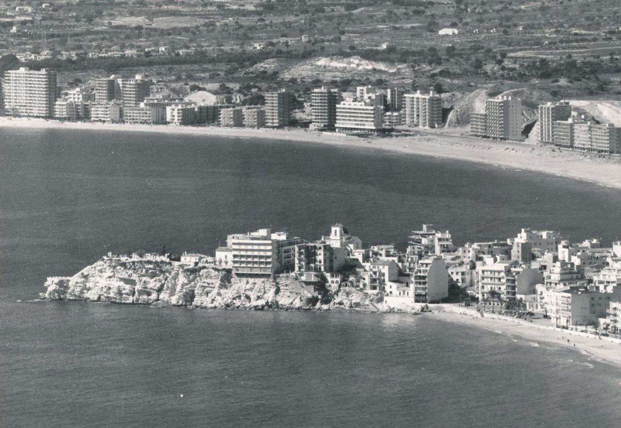
From the Serra Gelada: the old town with church and Planesia, behind it the first row of towers on Poniente.Photo: Archivo Fotográfico de la Dirección General de Turismo / Universidad de Zaragoza, CC BY-SA 2.0 - 2017
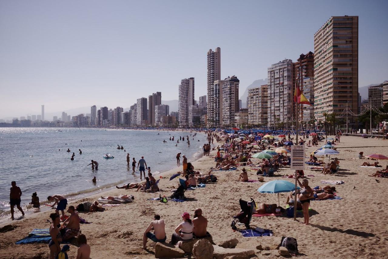
Levante beach today: the same bay that held a handful of hotels in 1942, now tower after tower all the way to Intempo.Photo: Nicolas Vigier, CC0 1.0